0
There are no products in your shopping cart!
We hope it's not for long.
We hope it's not for long.
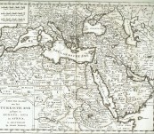
An original copper engraved map by Dutch cartographer Isaak Tirion (1705-1765) of the Turkish Empire. Published in Amsterdam 1730. Very good original condition with centrefold as issued. Incredible detail throughout. Mountain ranges shown pictorially.
Tirion produced several Atlases and Dutch town plans. Some suggest that his maps were based on those of Guillaume de L'isle although we see them as being much more detailed than de L’ísle’s standard.
Naturally the map takes in areas not part of the broader Turkish Empire and covers from Portugal in the west to Persia in the east, the Horn of Africa in the South and beyond the Crimea in the North
Price $120.00 unframed. Dimensions 34cm by 28cm.
Very good early 18th century Tirion Map
 Updating...

